From Wetlands to Farmland
Converting wetlands to farmland ended with about 14% of the homeland submerged. The beginnings of Dutch reclamation were trapped in an engineering dilemma—draining the soil made the land sink. How did this well-intentioned drainage lead to widespread submersion?

The Dutch Reclamation Dilemma
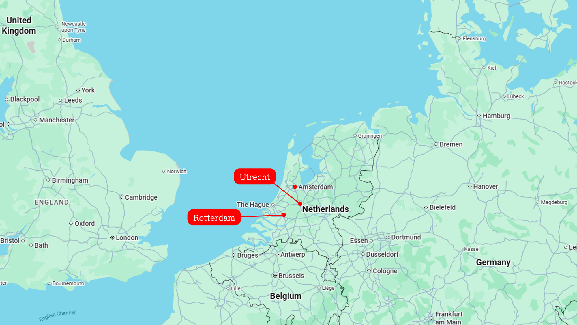
Until the early Middle Ages, the western region of the Netherlands—now home to major urban centers like Amsterdam, Rotterdam, and Utrecht—was little more than a vast expanse of wetlands. This area was like a colossal sponge, saturated with water to its absolute limit. Overgrown sphagnum moss, swamp-dwelling trees, meandering rivers, and immense, untamed peat bogs stretched to the horizon as far as the eye could see.
Around the 10th century, commoners began migrating to this formidable landscape. The catalyst was a rapid population boom in well-drained, higher-elevation regions. The existing habitable land had become physically insufficient to cultivate the grain required to feed everyone.
Additionally, this untamed frontier offered a distinct advantage: it lay beyond the reach of central authorities. Consequently, the common people were able to drive the reclamation process spontaneously and autonomously. Above all, these settlers needed to entirely transform the wetlands into environments capable of supporting grain cultivation.
How Drainage Created an Agricultural Surplus
To drain the water from the wetlands, the settlers first manually dredged the meandering rivers. Known as "peat streams," these waterways suffered from a lack of elevation gradient. Furthermore, they were choked with a continuous accumulation of undecomposed, dead vegetation, causing the water flow to remain highly stagnant.
After dredging lowered the water level and secured a steady flow, the settlers dug countless drainage ditches at right angles to the rivers, channeling the wetland waters directly into the streams. Thus, the wetlands were drained, preparing the ground for grain cultivation.
Moreover, as the surface moisture dissipated, the exposed peat dried and oxidized, releasing long-dormant, rich nutrients—such as nitrogen and phosphorus—to the surface. This chemical process transformed the landscape into fertile arable land, ideally suited for crops like barley and rye.
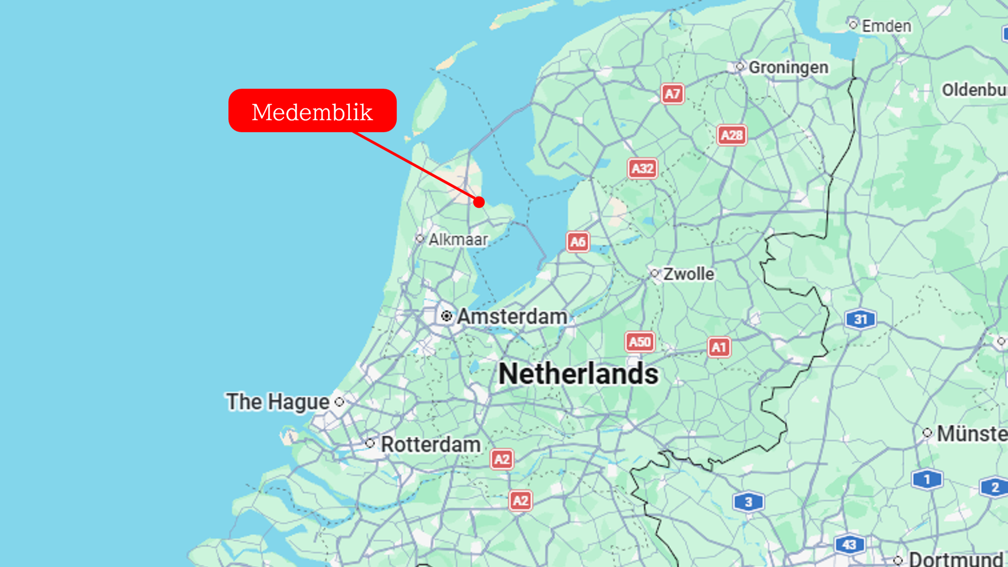
The success of this reclamation is clearly reflected in demographic shifts.As the food supply from the newly cleared lands expanded, the population of Medemblik, a key settlement in the western Netherlands, grew significantly between the late 9th and 11th centuries—expanding from roughly 120–200 to 360–600 inhabitants. It was precisely this agricultural surplus, far exceeding mere subsistence, that allowed the region to sustain populations engaged in trade and handicrafts.
The More They Dug, the More the Land Sank
Initially, after the drainage systems were constructed, the land was undeniably fertile. However, this prosperity was destined to be temporary.
The very process that released nutrients relied on the drying and oxidation of the peat. Oxidation essentially means that the solid ground converts into gas and vanishes. As the surface elevation dropped year by year, the critical height differential between the land and the surrounding water levels disappeared; consequently, digging further drainage ditches failed to expel the water.
It was not merely the fields that sank. The foundations of people's homes subsided right along with them. Typical houses of the era were built directly on the earth, featuring clay-lined floors and open hearths used for both heating and cooking.
As the ground subsided, frigid, muddy water began to seep up from beneath the floorboards. In the worst-case scenarios, the floors flooded completely, extinguishing the hearth fires. Residents repeatedly cut blocks of peat and dry clay from nearby wetlands, hauling them back to continually raise and repair their floors and hearth foundations.
Yet, even these stopgap measures eventually reached their limits. When this breaking point arrived, the people had no choice but to abandon the lands they had inhabited for years. Entire settlements were forced to relocate.
Indeed, multiple strands of archaeological evidence confirm that settlements initially established along the peat streams relocated in cycles ranging from several decades to a century. Traces of this phenomenon remain visible today.Because stone churches and cemeteries were left behind when settlements moved, they can still be found standing in isolation, hundreds of meters or even kilometers away from the current villages.
The Limits of Arable Land
Even the communities that persisted in farming through continuous relocation faced an ultimate limit between the 12th and 13th centuries. A convergence of structural factors made it impossible to maintain their previous coping strategies.
The first factor was the disappearance of destinations for relocation. As settlers repeatedly moved deeper into the peatlands to clear new ground, their expanding frontiers inevitably collided with other rivers, lakes, or the expanding reclamation zones of neighboring settlements. The untamed peatlands simply vanished.
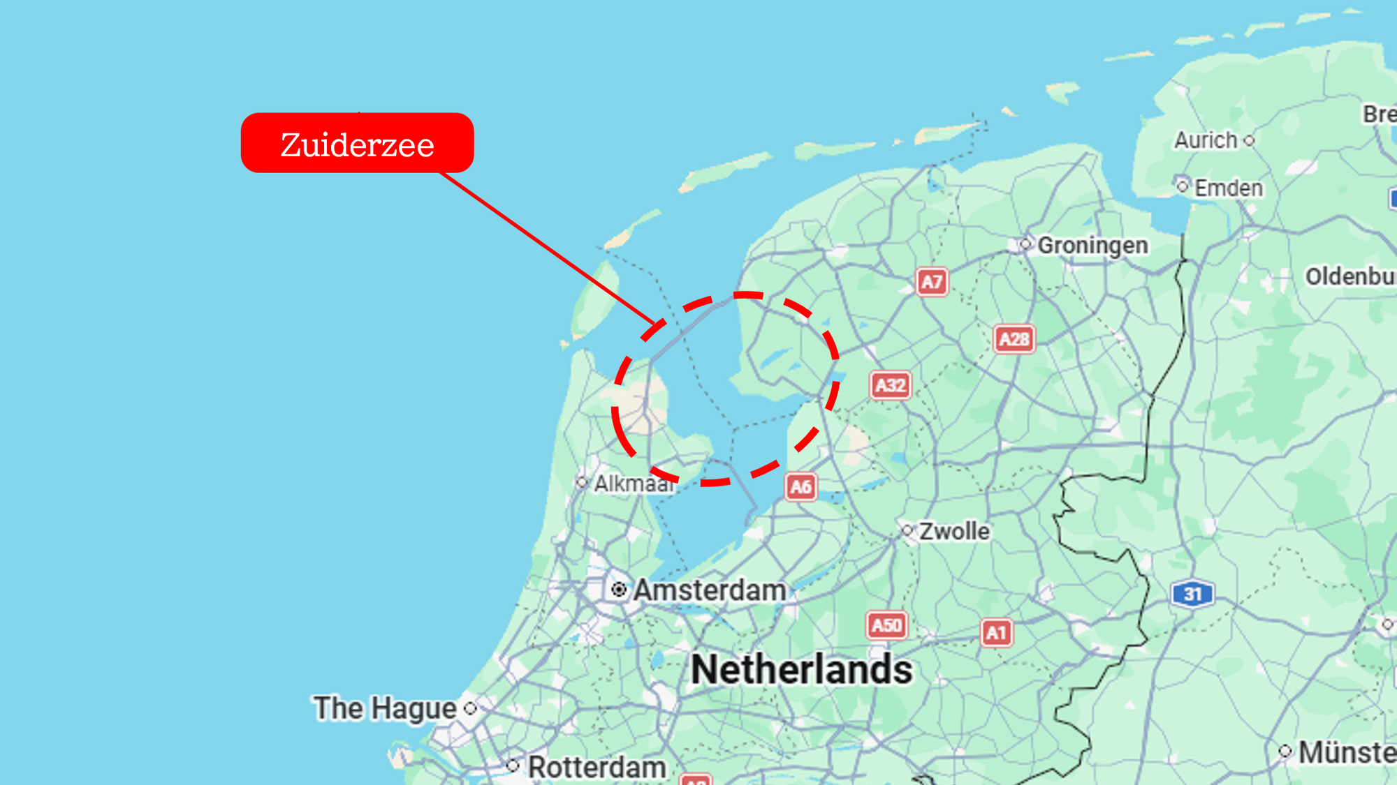
The second factor was the regional scale of the subsidence and the profound alteration of the surrounding water systems.Not only had land subsidence rippled across the entire region, but the intrusion of seawater—driven by phenomena such as the expansion of the Zuiderzee—caused the elevation of the entire area to plummet dangerously close to below sea level.
Zuiderzee
A vast, shallow inland sea that once existed in the central Netherlands. Repeated storm surges and tempests eroded existing freshwater lakes, connecting them to the North Sea and transforming them into a massive marine basin. Following the construction of major dikes in the 20th century, it is now the freshwater lake known as the IJsselmeer.
Faced with these environmental upheavals, the populace was forced to drastically alter its way of life. To combat the sinking land, the formerly scattered settlements mobilized entire regional communities to construct massive, large-scale dikes. Nevertheless, they could not reverse the decline in land available for crop cultivation...
After the Fields Sunk
From the 13th century onward, the land—though made increasingly waterlogged by subsidence—remained viable for livestock and dairy farming. Consequently, the populace transitioned to a socioeconomic structure centered around grazing and dairy, converting the landscape into pastures that could thrive even in damp soils. The people began exporting the resulting butter, cheese, and wool, engaging in trade to import the vital grain they needed to survive from outside the Netherlands.
Later, from the end of the 16th century, the metropolis of Amsterdam underwent rapid development. To meet the soaring urban demand, the people once again shifted their economic focus—this time from foreign export trade to commercial dairy production tailored for Amsterdam. From the 17th century onward, large-scale polder projects (land reclamation from bodies of water) were executed, successfully resurrecting former lakes into vast tracts of dry land. The pre-existing livestock and dairy industries thus experienced explosive growth in this newly reshaped landscape.
The Full Extent of the Submersion Damage
As detailed above, vast tracts of land were lost to the combined forces of drainage-induced subsidence and natural disasters like storm surges. Research calculating the total balance of this loss and subsequent recovery indicates that between approximately 1200 and 1900, roughly 500,000 to 600,000 hectares of land were lost.
The total area of the modern Netherlands is approximately 4.19 million hectares. While a nation-state called the "Netherlands" did not yet exist in the 12th century—meaning strict territorial borders differ—if one ventures a comparison with the modern national footprint, it equates to roughly 14% of the country's landmass sinking beneath the waves.
Conversely, the land acquired or recovered through polder projects from around 1200 to the present day amounts to only about 400,000 hectares. Even with the highly advanced land reclamation technologies of the modern era, the physical landmass lost in the past has never been entirely reclaimed.
Reference
①Jan van Doesburg
Medieval settlement dynamics in peatland reclamations in the western, central, and northern Netherlands
Settlement Change Across Medieval Europe: Old Paradigms and New Vistas (Ruralia XII), pp. 207-222 (16 pages)
https://www.sidestone.com/books/settlement-change-across-medieval-europe
②Marcel IJsselstijn en Jeroen Zomer
Van hoog naar laag: Een alternatief model voor veenontginningen?
Bulletin KNOB Vol. 123, No. 4 (2024), pp. 20-32 (13 pages)
https://bulletin.knob.nl/index.php/knob/en/article/view/839
③J. van Leeuwen
Middeleeuws Medemblik: Een centrum in de periferie. Archeologisch onderzoek naar de (vroeg)middeleeuwse handelsnederzetting en het oudste regionale centrum van West-Friesland in de periode 675-1289
West-Friese Archeologische Rapporten Vol. 61 (2014), pp. 1-351 (351 pages)